Translated automatically by AI from the Italian original.
PALERMO / ROME – A vast, intense Atlantic storm system is moving into the Italian peninsula, bringing with it thunderstorms, strong gusts of wind, local hail and a general deterioration in weather conditions from north to south.
Based on forecasts, the Civil Protection Department has issued a new adverse weather warning. For tomorrow, Wednesday 21 October, an amber alert has been assessed for Liguria and parts of Piedmont, Veneto, Friuli-Venezia Giulia, Lazio and Campania, while in Sicily and ten other regions a yellow alert has been issued for hydrogeological risk and storms.
The situation in the rest of Italy: emergencies in Sardinia and Liguria
The first effects of the bad-weather front have already been felt violently in recent hours:
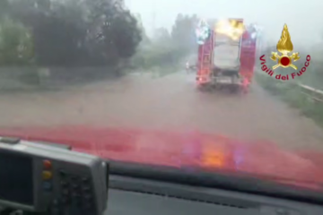
- Sardinia (Nuorese): A violent cloudburst hit the municipalities of Siniscola, Posada and Orosei, causing widespread flooding and making it necessary to evacuate several homes as a precaution. More than a hundred interventions are still pending for the Fire Brigade, which has been reinforced by crews from Sassari and Cagliari;
- Liguria (Savonese): The Rio Basco bursting its banks forced Anas to temporarily close the SS 334 del Sassello in both directions. There have also been disruptions along the Aurelia in Celle Ligure due to flooding and minor landslips;
- Piedmont: The Civil Protection operational room has officially been opened in Turin to monitor rising river levels, particularly in the Bormida and Orba basins.
Focus on Sicily: yellow alert across the island for 21 October
In Sicily, the Regional Civil Protection Department (DRPC) has issued Notice no. 26293, imposing a yellow alert (attention phase) across all nine alert zones on the island from 00:00 to 24:00 on Wednesday 21 October.
Rainfall is forecast to be “from isolated to scattered, including showers or thunderstorms”, with cumulative amounts from light to moderate, more pronounced along the Ionian coast and in western areas. At the same time, a marked strengthening of westerly winds is expected, with possible gale-force gusts and seas from very rough to locally stormy.
Mayors and local Civil Protection posts have been asked to activate monitoring phases and to pay particular attention to critical points on the road network and to catchment areas at risk of flooding.